
Inspecting a tall tower traditionally means a climb — rigging, fall protection, and hours at height on a structure that was never designed to be climbed. A drone survey covers the full height of the tower in a single flight, photographing steelwork, fixings, and joints in high-zoom detail while everyone stays on the ground.
This page covers towers and tall structures outside the telecoms network — broadcast and TV towers, observation and viewing platforms, floodlight pylons, and similar assets. Telecoms masts and monopoles have their own dedicated page.
What towers do you inspect?
Broadcast and TV towers, observation and viewing platforms, floodlight pylons, and other tall standalone structures.
Telecoms masts are covered on a dedicated pageDoes anyone need to climb the tower?
No. The drone surveys the structure from a safe standoff distance, so no person works at height. This satisfies S.I. No. 318 of 2006 at the first step of the hierarchy of control — the duties for fall protection and rescue do not arise.
More about our regulatory complianceCan a 3D model of the tower be produced?
Yes. A photogrammetric 3D model gives a measured digital record of the tower that can be re-flown in future years to quantify change — crack movement, coating loss, and the effectiveness of repairs.
More about 3D mapping






































A single flight covers the full height of the tower, photographing steelwork, welds, and connections at close range. What the survey typically detects: corrosion and coating failure on structural members, loose or missing fixings, cracking around joints, and damage to ladders, platforms, and safety systems.
What about working at height regulations in Ireland?
The Safety, Health and Welfare at Work (Work at Height) Regulations 2006 (S.I. No. 318 of 2006) require that work at height be avoided where it is reasonably practicable to do so. A drone survey satisfies this at the first step of the hierarchy of control — the structure is surveyed from a safe standoff distance with no personnel working at height.
More about our regulatory compliance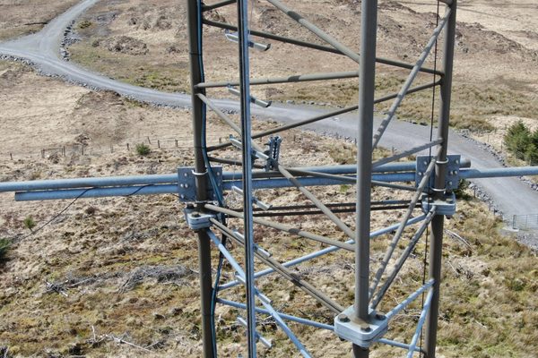
High-zoom photography resolves the detail a ground inspection cannot reach — the condition of individual bolts, weld seams, guy terminations, and flange joints — while the drone stays well clear of the structure. This is where degradation shows first, and where a climbing inspection is slowest and most intrusive.
What detail can the survey resolve?
Fixing corrosion, cracked welds, failed coatings, and displaced components can all be recorded at close range — enough detail for an engineering assessment or a repair specification without a second visit.
Discuss your survey requirements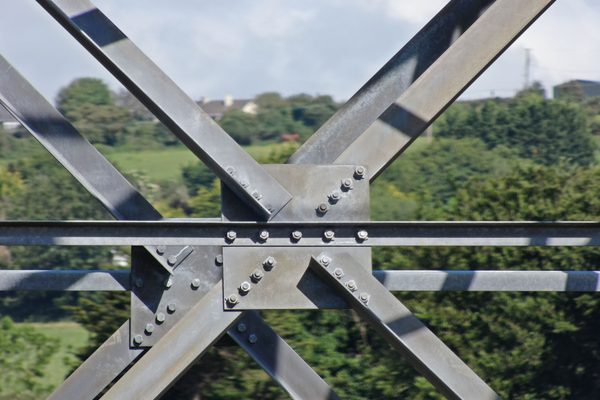
A photogrammetric 3D model turns the survey imagery into a measured digital record of the tower — every surface located in space, rotatable, zoomable, and measurable on screen. Re-flown in future years, it quantifies change: crack movement, coating loss, and the effectiveness of repairs.
What is a photogrammetric model?
A photogrammetric model is a 3D replica built from overlapping drone photography, geometrically corrected so distances can be measured accurately on screen — a digital twin of the tower as it stands on the day of the survey.
More about 3D mapping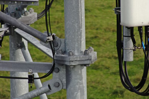
Every finding is compiled into a structured condition report: photographed, described, classified by defect type, and assigned a severity level. A simple orientation diagram shows where each defect sits on the structure, so a maintenance or repair team can go directly to the marked locations.
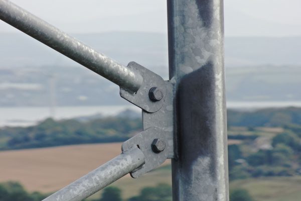
The survey is flown from ground level — no rigging, no fall protection, no personnel at height. Satisfies S.I. No. 318 of 2006 at the first step of the hierarchy of control.
The complete structure photographed from base to tip, with every face and elevation captured in a single deployment.
Bolts, welds, and coatings resolved in close-up while the drone stays well clear of the structure.
A measured photogrammetric record of the tower, re-flown in future years to quantify change.
Fast visual surveys after a weather event establish the status of the structure and cabling before anyone climbs.
Each defect described, classified, and located on an orientation diagram for the maintenance team.
A manual inspection of a tall tower means rigging, fall protection, and hours at height — on a structure that may not have been climbed in years. A drone survey covers the same structure in a single flight, capturing every face and every fixing while the team stays on the ground.

A photogrammetric 3D model of the tower is a dated record of its condition — measurable on screen today, and directly comparable against a re-flight in future years. Crack movement, coating loss, and the effectiveness of repairs are quantified rather than estimated.
Faster reports and diagnosis mean quicker implementation of fixes with savings made in the short and long-term. The zoom capabilities of our cameras mean that, even from a distance, the quality of the image recorded is of super-high detail.
It is important to perform inspections of your tower assets on a routine basis. This is to ensure they are structurally safe for maintenance personnel and the public. Inspections using drones are a proven low-cost way to help gather vital information to help prioritise and plan maintenance activities.
A pre-climb drone inspection will optimise your technicians' time. It will not only identify potential climbing and safety issues, but also the right tools needed for any repairs. This not only reduces the risk to maintenance teams by avoiding multiple dangerous climbs, but also the overall cost.
We perform fast visual inspections of towers to determine the status of the structure and cabling after a storm. Our status report will help you prioritise the needed repairs.
Tell us what you need to know, and we will work with you to design actionable deliverables that give you the outcomes you need.
A typical tower inspection delivers a full photographic survey of the structure from base to tip, with high-zoom imagery of every identified defect, compiled into an annotated condition report.
Where a 3D model is required, a photogrammetric record of the tower can be produced and re-flown in future years, quantifying change against the original survey.
The complete structure photographed from base to tip in a single flight.
Close-up records of fixings, welds, and coatings for engineering assessment.
A measured photogrammetric record, comparable against future surveys.
Each defect described, classified, and located for the maintenance team.
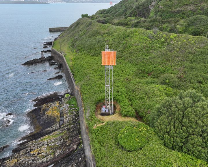
A drone condition survey of the ship navigation leading line towers at the entrance to Cork Harbour, capturing the lattice structure, the high-visibility boards, the lighting, the solar panels and the wiring without working at height.
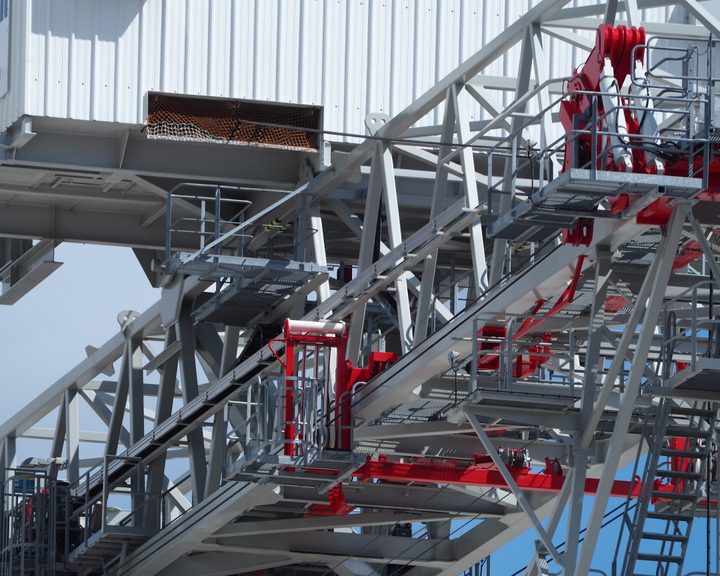
Engineers With Drones used a high-optical-zoom drone to inspect a derelict crane at a Cork port terminal ahead of decommissioning.
Complex surveys and inspections require more than just a pilot. Our engineers can help you scope your requirements and indentify the right approach.