
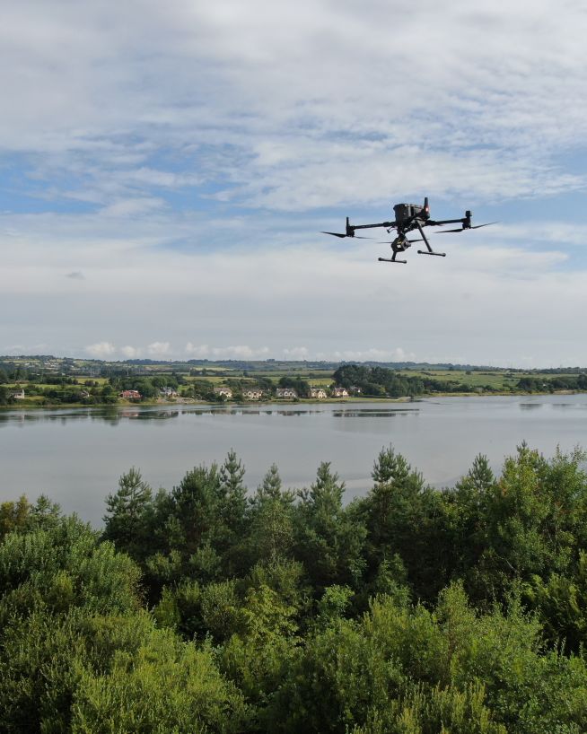
The vast majority of property purchases today take place online. There has never been a better time to stay ahead of the curve. Traditional methods used to capture aerial footage, i.e. helicopters and planes, are expensive, time-consuming and offer limited visibility. Using drones allows you to view, record and showcase your property from unique angles. Drone footage enhances the appeal of your property listings and wows potential buyers. Engineers With Drones will capture stunning aerial photography and birds-eye video footage. Helping to highlight your property's proximity to its nearby amenities, roads, and neighbourhood. And this at a fraction of the cost of traditional methods.
More and more people in real estate are turning to drone services to demonstrate the scale and size of the interior as well as exterior of a property. Engineers With Drones will not only make your property listing shine, we will also ensure that you can showcase your property with confidence to potential buyers, sellers, colleagues and other stakeholders.
Our stunning high-definition aerial photography and video footage will help to:
With a traditional ground-based photo shoot of a property, potential buyers are asked to fill in the dots of the surrounding landscape. Adding aerial images allows someone to get a feel for the lay of the land and the property’s relationship to it. We provide high-definition photos and videos of:
Engineers With Drones offer a fast, professional and cost-effective package for all your business needs. Helping you to put your best foot forward when showcasing your property. Contact us today and we can talk you through the process.

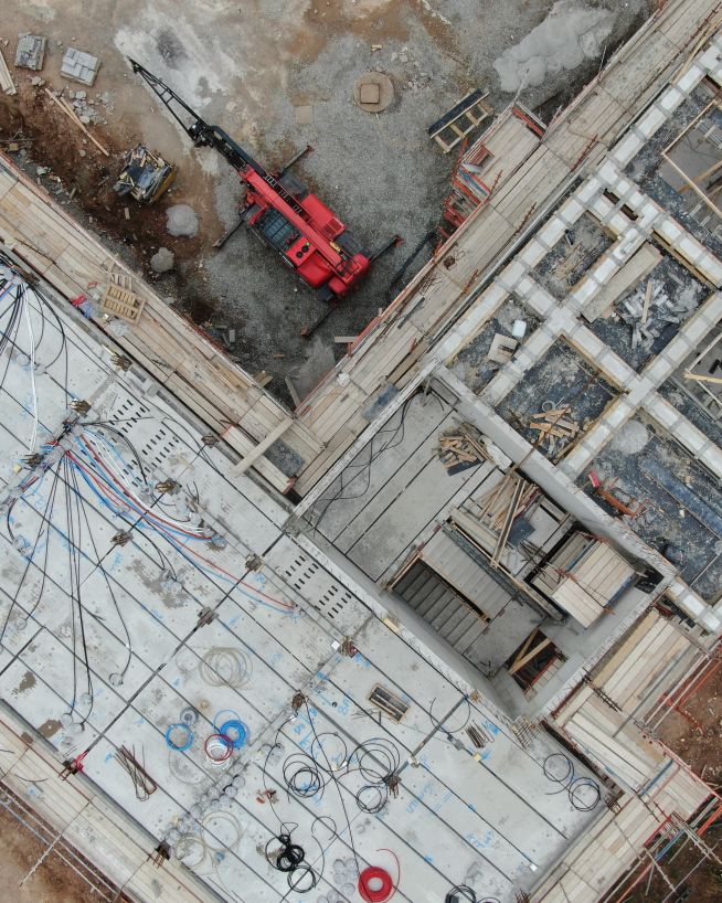
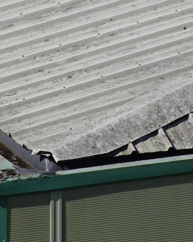
Drones are not just a marketing tool. They can be useful for real estate companies in other ways as well: to survey land, inspect roofs & buildings, property and land valuations, assess damage and more...
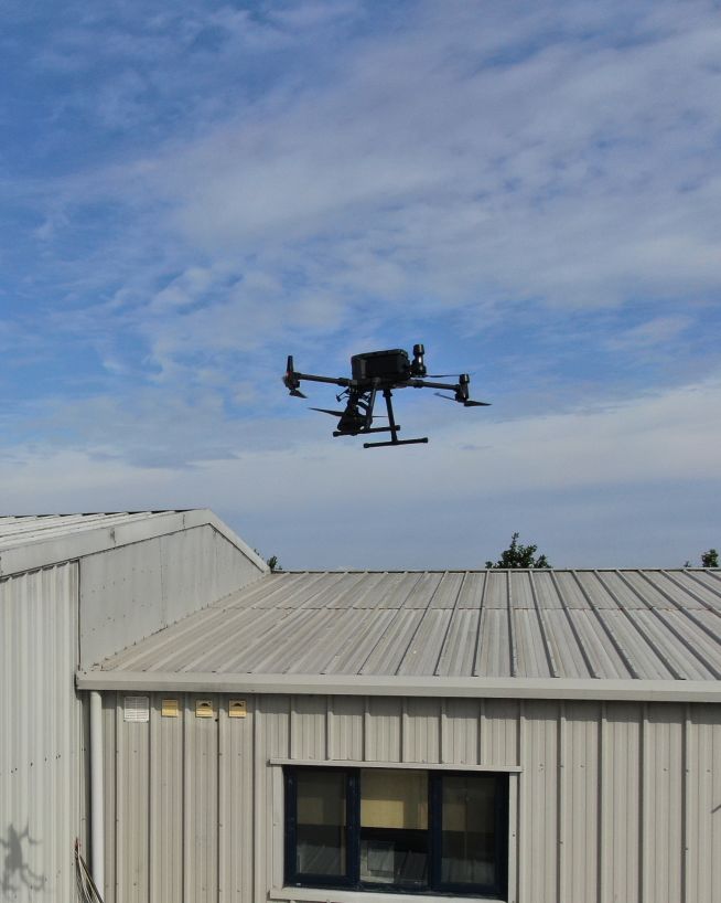
We purchase the latest drones as they come on the market to ensure you are getting the highest quality service from us at all times. Here is a quick look at what we would be most likely to use for a typical drone real estate inspection.

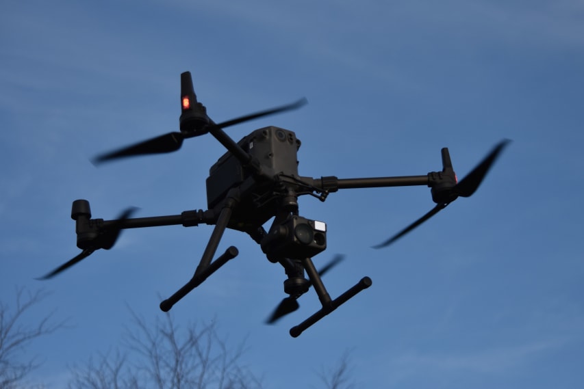
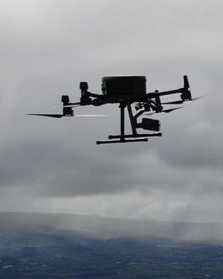
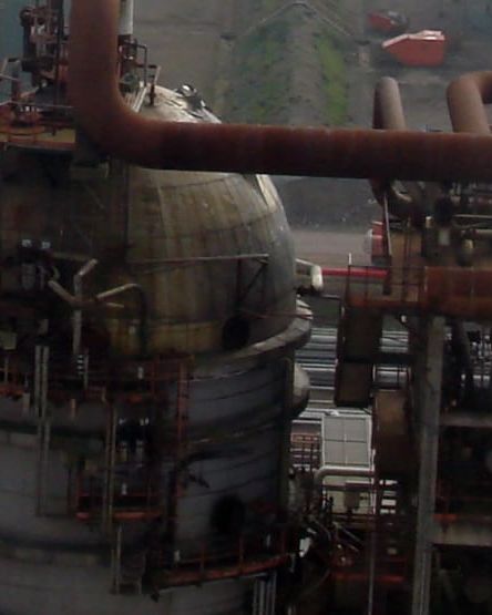
The M300 RTK by DJI is the premier enterprise-level inspection drone on the market. With a flight time of up to 55 minutes, lots of built-in redundancy, and a host of payloads to choose from, this is our go-to UAV for inspection work. When coupled with the Zenmuse H20T camera, it is capable of safely inspecting high-value assets at a stand-off range.

One payload with a multitude of sensors. The H20T is specifically designed for conducting inspections of high-value assets. When coupled with the Matrice M300 aircraft, the various sensors on the H20T give the operator a wide array of options to get the best imagery possible.

Small yet powerful. This tiny drone is our go-to drone for anything where we may be close to uninvolved people. The combination of its small size and powerful 48mp camera make it the ideal drone for urban and built-up areas where ground risk is a key consideration.

This underwater UAV is our industrial AI underwater robot, engineered for high-precision measurements, inspections, and surveys in complex marine environments. With advanced sensors and sonars, it ensures our projects with accuracy and reliability beyond standards.

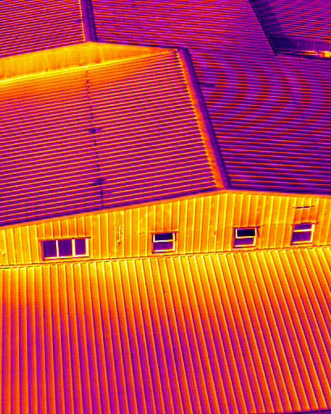
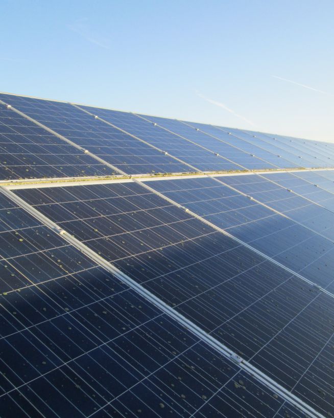
We can deploy this highly portable and versatile UAV at a moment's notice. It is designed for an array of industries and situations where thermal imaging and speed of work is of the essence; such as identifying heat loss and structural defects, conducting solar plant inspections or any low-light/low-visibility environment survey.

Our flagship drone: The M350 RTK by DJI is the premier enterprise-level inspection drone on the market, an update to our workhorse M300 RTK. With a flight time of up to 55 minutes, lots of built-in redundancy, and a host of payloads to choose from, this is our go-to UAV for inspection work.

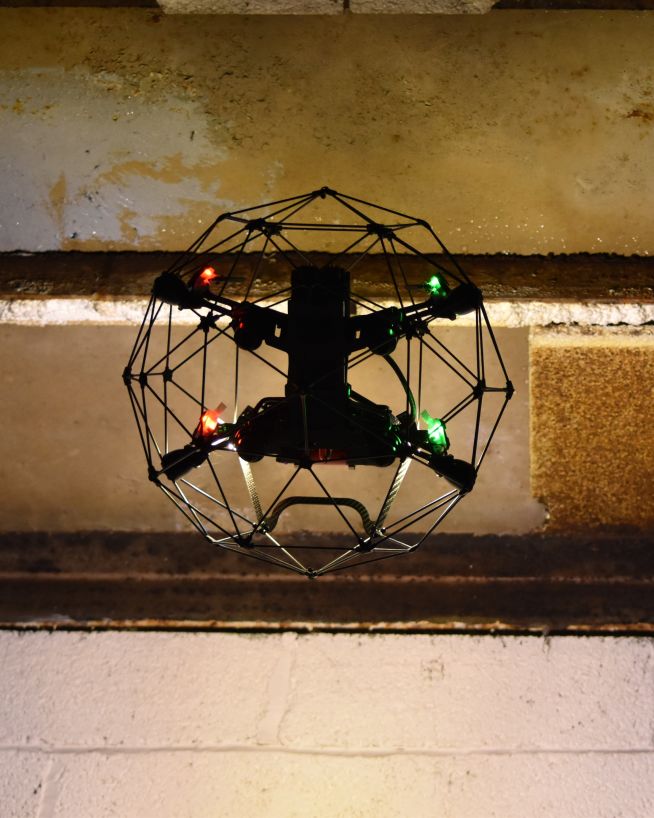
With this high-end Class 0 light-weight drone, we're able to reliably shoot in almost any condition and location, utilising its smaller size and spot-on obstacle avoidance to gather deliverables from more densely populated areas in the safest way possible.

The QYSEA Fifish V6 is a cutting-edge underwater drone. One of the standout features of the Fifish V6 is its exceptional manoeuvrability. It boasts six thrusters, which allow for precise control and agile movement, ensuring that users can navigate through tight spaces and capture stunning footage with ease.

Powerful yet attentive. The Mavic 3 Enterprise is the perfect discrete mapping and inspection drone. This is our go-to aircraft for missions where flying large drones would either be illegal or cause a disturbance. This powerful little drone gets the job done without showing off.
Read more...
Read more...
Read more...
Read more...
Read more...
Read more...
Read more...
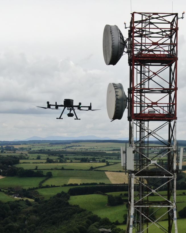
Here at Engineers With Drones, we fly the latest cutting-edge drones. Our UAVs are selected specifically for the tasks they perform. Drones such as the DJI M300 and payloads such as the Zenmuse H20T with high optical zoom lenses are optimal for safely inspecting high-value assets at a stand-off range.
To find out more about our drone equipment and what it can do click here.
Contact us today to see what we can do for you...


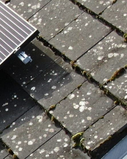
Ensure solar panel efficiency from precise data collection
Reduced risk, damage to towers and delays
Eliminates downtime and safety concerns, at a fraction of the cost
Actionable data from a safe distance, with less downtime
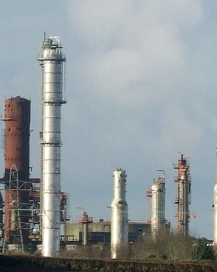
Safer and more cost-efficient flare (oil and gas) inspections
Get fast, usable data from a safe distance
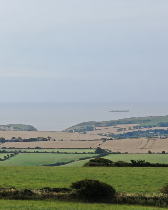
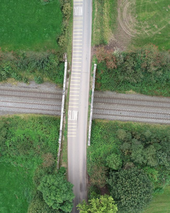
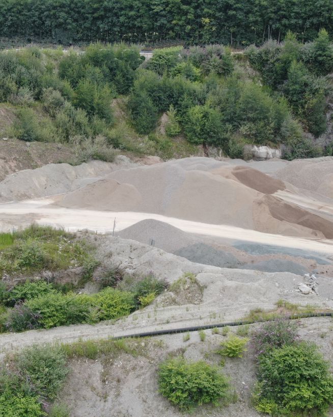
Faster, cheaper and more accurate analysis of land
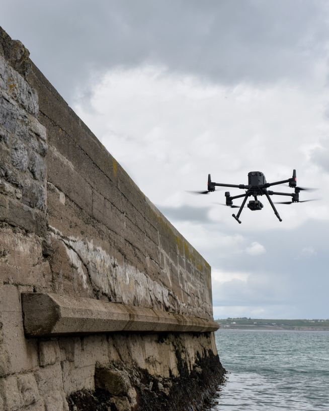
Monitor coastal assets safely and with more precision

Accurate and efficient analysis of crops and land
Endless perspectives, without manned aircrafts or structures
Safer, more cost-efficient, with less downtime
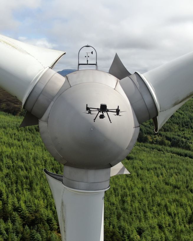
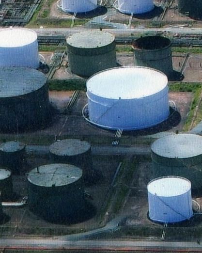
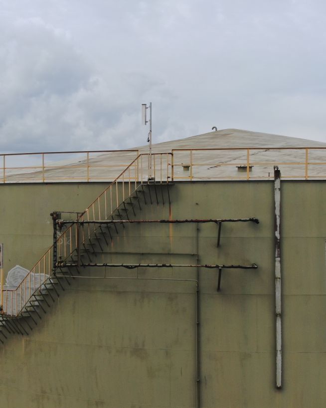
Inspect and maintain energy assets without risk or downtime
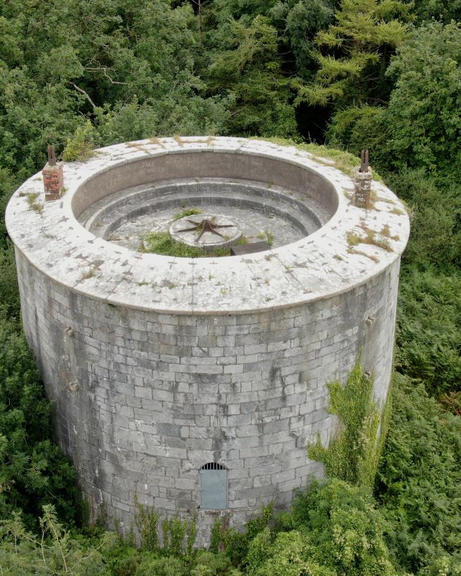
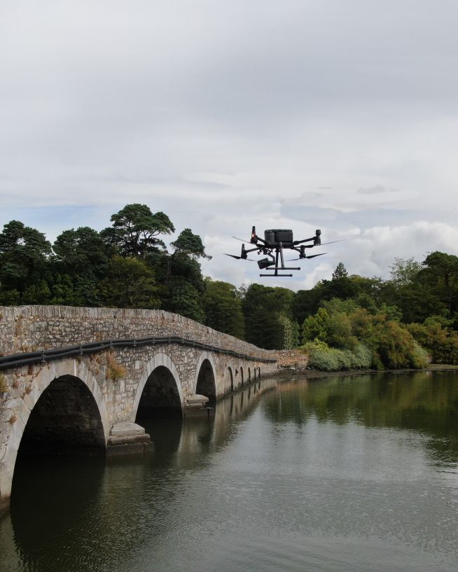
Analyse historical buildings without risk to people or property
Instantly view complex structures, keeping risks to a minimum
Critical, pinpoint details with none of the risk
Safer, more precise data collection at a fraction of the cost
Instant, actionable data with no downtime
Record and document reliable visuals without safety concerns
A more cost- and time-effective way to receive critical data
Eliminate safety concerns, save costs and reduce downtime
Keep production running while collecting instant critical data
Fast, actionable data without the risks of traditional inspections
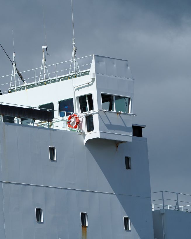
Safe, precise and instant reports on vessels and infrastructure
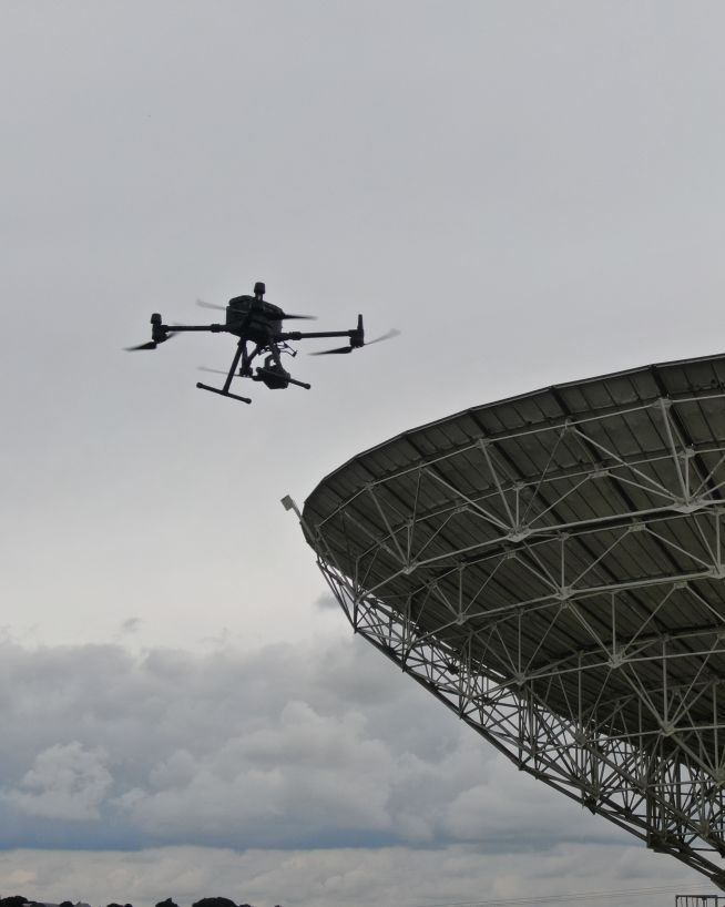
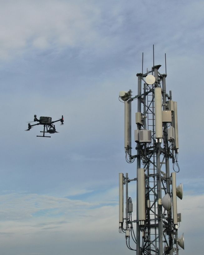
Get critical data on cell and telecommunication infrastructure
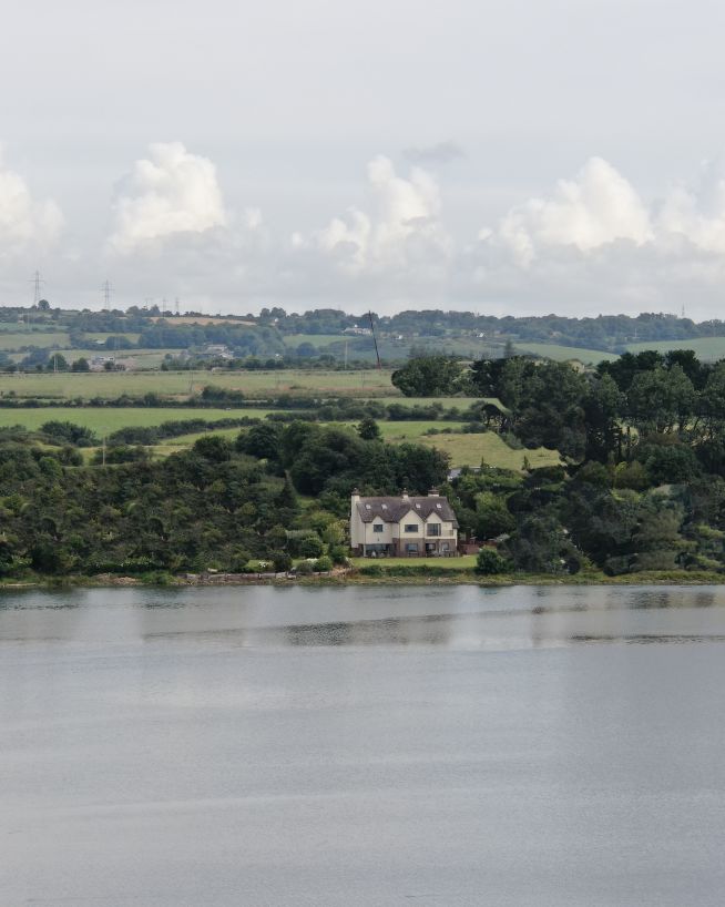
Add "Wow Factor" to residential and commercial property listings
Accurate, safe and instantly actionable data collection
Get actionable data on quality and operational health
Clearer, faster results without the risks
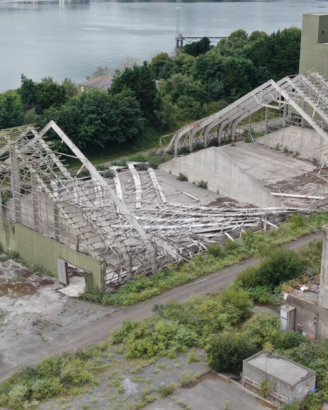
Assess damage quickly and with pinpoint accuracy
Monitor status and progress without downtime
Instantly usable data via a safer and more cost-effective process
Optical zoom is a feature found in cameras that allows you to change the focal-length of the lens, which in turn magnifies the image. Unlike digital zoom, which simply enlarges the pixels of an image, optical zoom physically moves the lens elements to zoom in or out, resulting in a higher-quality, more detailed image.
Optical zoom is better than digital zoom for several reasons. Firstly, optical zoom maintains the image quality and sharpness because it captures more detail from the subject. In contrast, digital zoom often results in a pixelated, blurry image because it enlarges the existing pixels of an image, which degrades the quality.
Secondly, optical zoom allows you to get closer to your subject without physically moving closer, which can be useful in situations where you cannot or do not want to approach your subject closely. This can be especially helpful for wildlife photography or for taking photos of events from a distance.
Overall, optical zoom is a valuable feature that can help you capture high-quality, detailed images from a distance, making it a must-have for many photographers.

UAV (Unmanned Aerial Vehicle): UAV is the technical term for a drone. It refers to any aircraft that can be operated without a human pilot on board.
UAS (Unmanned Aircraft System): UAS encompasses not just the drone itself (UAV) but also the associated ground control station, communication systems, and any additional equipment required for its operation.